
November 1, 2021
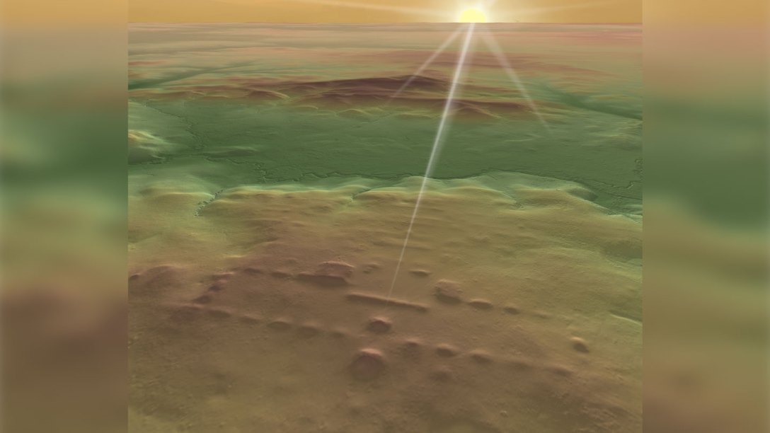
LIDAR has uncovered information about the Olmec site of Buenavista dated at 3,000 years ago. It shows that sunrise aligns with the entrance to the site. This new research has revealed 478 ceremonial centers across Mexico’s Gulf Coast in the OImec heartland stretching 400 miles to the Maya lowlands. The finding shows that there was a 2,000 year old blueprint for ceremonial construction in all of these sites. Most of these new LIDAR discoveries stretch from 1050 BCE-400 BCE.
The LIDAR found an unknown area of the Olmec site of San Lorenzo dating to 1050 BCE to 400 BCE. This consisted of 20 rectangular earthen mounds around a central plaza. This blueprint was adopted at the site of Aguada Fénix 400 kilometers away dated at 1,000 BCE. Later sites followed this 20 mound layout surrounding a central plaza.
The research is published in the journal Nature Human Behavior.
Science News has the report here:
https://www.sciencenews.org/article/lidar-blueprint-olmec-maya-ceremonial-archaeology
Phys.org adds that the entrance ways and layouts seem to be geared to the Sun’s zenith. This occurs on May 10 in the region where the sites were found. This day marks the beginning of the rainy season and the planting of maize.
https://phys.org/news/2021-10-ancient-ceremonial-sites-southern-mexico.html
A lot more research will now begin based on these findings.
Mike Ruggeri’s Olmecs
http://mikeruggerisolmecs.tumblr.com
Mike Ruggeri’s Olmecs
http://mikeruggerisolmecs.tumblr.com

[…] 472 New Sites Uncovered by LIDAR on the Mexican Gulf Coast. — MIKE RUGGERI’S ANCIENT AMERICA… […]